Category:Napton on the Hill
Jump to navigation
Jump to search
village in United Kingdom  | |||||
| Upload media | |||||
| Pronunciation audio | |||||
|---|---|---|---|---|---|
| Instance of | |||||
| Location | Stratford-on-Avon, Warwickshire, West Midlands, England | ||||
| Population |
| ||||
| Area |
| ||||
| Said to be the same as | Napton on the Hill (Wikimedia duplicated page, civil parish) | ||||
| official website | |||||
 | |||||

English: Napton on the Hill, (often referred to locally as just Napton), is a small village and civil parish in the Stratford district of Warwickshire, England. Napton is near the A425 road between the towns of Daventry and Southam, which is a few miles to the west of the village.
Norsk bokmål: Napton on the Hill (oftest kalt bare Napton) er en liten landsby i Warwickshire, England. Den ligger mellom byene Southam og Daventry. Som navnet antyder ligger den på en åsrygg, og har utsikt mot Oxfordkanalen.
Main Wikipedia article: Napton-on-the-Hill.
Subcategories
This category has the following 10 subcategories, out of 10 total.
C
- Calcutt Locks (6 F)
N
- Napton Co-operative Society (1 F)
- Napton Reservoir (20 F)
O
- Oxford Canal Bridge 114 (5 F)
- Oxford Canal Bridge 115 (5 F)
P
W
- Napton on the Hill Windmill (20 F)
Media in category "Napton on the Hill"
The following 200 files are in this category, out of 416 total.
(previous page) (next page)-
 A bend in the A425 - geograph.org.uk - 3906864.jpg 640 × 480; 46 KB
-
 A livestock drinking pool, Napton - geograph.org.uk - 1272874.jpg 640 × 467; 157 KB
-
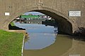
 A425 bridge over the Oxford canal - geograph.org.uk - 5198760.jpg 5,184 × 3,456; 7.44 MB
-
 A425 heading east - geograph.org.uk - 3906854.jpg 640 × 480; 43 KB
-
 A425 heading east - geograph.org.uk - 3906857.jpg 640 × 480; 44 KB
-
 A425 passes The Bridge Inn - geograph.org.uk - 3105707.jpg 3,648 × 2,736; 1.59 MB
-
 A425 passes The Kings Head - geograph.org.uk - 3105712.jpg 3,648 × 2,736; 1.2 MB
-
 A425 through Napton on the Hill - geograph.org.uk - 3906870.jpg 640 × 480; 54 KB
-

-
 An old cart, Lower Fields, Napton - geograph.org.uk - 1272864.jpg 640 × 484; 148 KB
-
 Approaching Napton Bottom Lock - geograph.org.uk - 6261316.jpg 1,280 × 851; 349 KB
-

-
 Automotive Products Sailing Club - geograph.org.uk - 3819890.jpg 2,000 × 1,260; 586 KB
-
 Automotive Products Sailing Club - geograph.org.uk - 3824073.jpg 2,000 × 1,362; 627 KB
-
 Automotive Products Sailing Club - geograph.org.uk - 3824131.jpg 2,000 × 1,343; 615 KB
-
 Automotive Products Sailing Club - geograph.org.uk - 3824161.jpg 1,500 × 2,106; 738 KB
-
 Automotive Products Sailing Club - geograph.org.uk - 3824241.jpg 2,000 × 1,301; 729 KB
-
 Automotive Products Sailing Club - geograph.org.uk - 3824788.jpg 2,000 × 1,333; 651 KB
-
 Barrell-roof at Calcutt - geograph.org.uk - 1087370.jpg 640 × 533; 200 KB
-

-
 Boat moored near Bridge 110, Napton Bridge - geograph.org.uk - 4501856.jpg 1,024 × 842; 306 KB
-
 Boats moored near Napton - geograph.org.uk - 1114147.jpg 640 × 498; 91 KB
-

-
 Brickyard Bridge, Napton - geograph.org.uk - 1106241.jpg 640 × 455; 110 KB
-
 Brickyard Road crossing the Oxford Canal - geograph.org.uk - 4501935.jpg 1,024 × 768; 224 KB
-
 Brickyard Road junction, Napton - geograph.org.uk - 1106204.jpg 640 × 479; 108 KB
-
 Brickyard Road, Napton, pond - geograph.org.uk - 1106214.jpg 640 × 460; 122 KB
-
 Bridge 109, Coventry Road Bridge - geograph.org.uk - 4501828.jpg 1,024 × 746; 273 KB
-
 Bridge 111 crossing the Oxford Canal - geograph.org.uk - 4501914.jpg 1,024 × 788; 245 KB
-
 Bridge 112, Napton Brickyard Bridge - geograph.org.uk - 4502857.jpg 1,024 × 768; 242 KB
-
 Bridge 113, Folly Bridge - geograph.org.uk - 4502924.jpg 1,024 × 765; 240 KB
-
 Bridge 113, Oxford Canal - geograph.org.uk - 2377499.jpg 640 × 480; 108 KB
-
 Bridge 116, Greens Lock Field Bridge - geograph.org.uk - 4511017.jpg 1,024 × 742; 264 KB
-
 Bridge 17, Wigrams Bridge at Napton Junction - geograph.org.uk - 4501219.jpg 1,024 × 732; 204 KB
-
 Bridge Nursery near Napton - geograph.org.uk - 1114562.jpg 640 × 423; 50 KB
-

-
 Bridge over the Oxford Canal - geograph.org.uk - 2336893.jpg 640 × 480; 116 KB
-
 Butt Hill sewage pumping station - geograph.org.uk - 1424629.jpg 640 × 470; 124 KB
-
 Byre south of Napton - geograph.org.uk - 1273050.jpg 640 × 483; 109 KB
-
 Canal bridge near Napton - geograph.org.uk - 2336835.jpg 640 × 480; 104 KB
-
 Carousel entering Lock 12, Oxford Canal. - geograph.org.uk - 2411936.jpg 4,000 × 2,248; 1.85 MB
-
 Carousel heading South out of Lock 12, Oxford Canal. - geograph.org.uk - 2411948.jpg 3,904 × 2,060; 2.91 MB
-
 Carp pool, Napton - geograph.org.uk - 1261235.jpg 640 × 426; 102 KB
-
 Chapel Green - geograph.org.uk - 3511814.jpg 1,024 × 768; 154 KB
-
 Chapel Green - geograph.org.uk - 3521501.jpg 1,024 × 768; 222 KB
-
 Chapel Green Cottages - geograph.org.uk - 1866027.jpg 640 × 402; 54 KB
-
 Chapel Green Millennium Way - geograph.org.uk - 3521517.jpg 1,024 × 785; 212 KB
-
 Chapel Green sewage pumping station - geograph.org.uk - 1269836.jpg 640 × 449; 118 KB
-
 Chapel Green, Napton (1) - geograph.org.uk - 1269818.jpg 640 × 432; 97 KB
-
 Chapel Green, Napton (2) - geograph.org.uk - 1269825.jpg 640 × 480; 100 KB
-
 Chapel Green-Oxford Canal - geograph.org.uk - 1865941.jpg 640 × 480; 85 KB
-

-
 Coventry Road Bridge, Oxford Canal - geograph.org.uk - 2120546.jpg 1,280 × 856; 204 KB
-
 Cross Roads Garage - geograph.org.uk - 3818122.jpg 2,000 × 1,333; 946 KB
-
 Crossing Stockton Road Canal Bridge - geograph.org.uk - 2121009.jpg 1,280 × 856; 228 KB
-
 Damaged towpath along the Oxford Canal - geograph.org.uk - 4501921.jpg 904 × 1,024; 251 KB
-

-
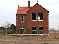 Derelict house, Napton brickyard - geograph.org.uk - 1106258.jpg 640 × 477; 88 KB
-

-
 Descending Butt Hill, Napton on the Hill - geograph.org.uk - 4614048.jpg 800 × 579; 129 KB
-

-
 Dilapidated byre near Potash Farm - geograph.org.uk - 1498948.jpg 640 × 426; 178 KB
-
 Dilapidated byre south of Napton (2) - geograph.org.uk - 1497081.jpg 640 × 426; 101 KB
-

-
 Downhill to Napton (1) - geograph.org.uk - 1261203.jpg 640 × 426; 129 KB
-
 Downhill to Napton (2) - geograph.org.uk - 1261217.jpg 640 × 506; 86 KB
-
 Dry pond near Potash Farm - geograph.org.uk - 1498949.jpg 640 × 426; 177 KB
-
 Duck and swan food on the Oxford Canal - geograph.org.uk - 6260006.jpg 851 × 1,280; 694 KB
-
 Dun cow south of Napton - geograph.org.uk - 1497182.jpg 640 × 426; 113 KB
-
 East along Holt Road towards Chapel Green - geograph.org.uk - 4505082.jpg 1,024 × 768; 205 KB
-
 Elder berries beside a farm track - geograph.org.uk - 1497083.jpg 640 × 426; 134 KB
-

-

-
 Entering Lock 13 on the Oxford Canal - geograph.org.uk - 2432926.jpg 1,024 × 770; 198 KB
-

-
 Entrance to Wigrams Turn Marina - geograph.org.uk - 4614058.jpg 800 × 568; 102 KB
-
 Evening sky at Napton locks - geograph.org.uk - 2432939.jpg 683 × 1,024; 124 KB
-
 Fallen tree near Halls Barn Farm - geograph.org.uk - 1263477.jpg 640 × 459; 121 KB
-
 Farm building, Napton on the Hill - geograph.org.uk - 3906859.jpg 640 × 518; 42 KB
-
 Farm buildings at Marston Doles - geograph.org.uk - 2253161.jpg 1,280 × 856; 237 KB
-
 Farm buildings at Napton Hill - geograph.org.uk - 4502884.jpg 1,024 × 787; 228 KB
-
 Farm track east of Napton (1) - geograph.org.uk - 1497089.jpg 640 × 426; 117 KB
-
 Farm track east of Napton (2) - geograph.org.uk - 1497090.jpg 640 × 426; 89 KB
-
 Farm track east of Napton (3) - geograph.org.uk - 1497092.jpg 640 × 422; 121 KB
-
 Farmhouse at Holroyd Farm - geograph.org.uk - 4613998.jpg 800 × 569; 104 KB
-
 Farmland near the Oxford Canal - geograph.org.uk - 4501900.jpg 1,024 × 701; 206 KB
-
 Farmland north of Potash Farm - geograph.org.uk - 1498950.jpg 640 × 426; 68 KB
-
 Farmland south of Shuckburgh - geograph.org.uk - 1263471.jpg 640 × 453; 96 KB
-
 Farmland south of Shuckburgh Road - geograph.org.uk - 3906879.jpg 640 × 532; 46 KB
-
 Farmland, Napton Fields - geograph.org.uk - 3906856.jpg 640 × 480; 49 KB
-
 Farmland, Napton on the Hill - geograph.org.uk - 3906860.jpg 640 × 480; 28 KB
-
 Field near Clearwater Business Park - geograph.org.uk - 6241254.jpg 800 × 600; 134 KB
-
 Folly Lane, Napton on the Hill - geograph.org.uk - 6144397.jpg 1,280 × 851; 467 KB
-
 Folly Wharf, Oxford Canal - geograph.org.uk - 6144037.jpg 1,280 × 851; 517 KB
-
 Former site of sailing club - geograph.org.uk - 3824070.jpg 2,000 × 1,333; 764 KB
-
 Grand Union Canal east of Napton Junction - geograph.org.uk - 2121406.jpg 1,280 × 856; 283 KB
-
 Grand Union Canal near Napton Junction - geograph.org.uk - 4501242.jpg 1,024 × 715; 208 KB
-
-
 Grand Union Canal seen through Bridge 17 - geograph.org.uk - 3105761.jpg 3,648 × 2,736; 1.54 MB
-

-

-
 Grand Union Canal, Napton on the Hill - geograph.org.uk - 2122270.jpg 1,280 × 856; 227 KB
-

-

-

-
 Grazing, Napton Fields Farm - geograph.org.uk - 3906851.jpg 640 × 480; 73 KB
-
 Grazing, Napton Fields Farm - geograph.org.uk - 3906855.jpg 640 × 480; 35 KB
-
 Grazing, Napton on the Hill - geograph.org.uk - 3906873.jpg 640 × 480; 56 KB
-
 Grazing, Roadside Farm - geograph.org.uk - 3906881.jpg 640 × 480; 52 KB
-
 Greens Lock No 14 on the Oxford Canal - geograph.org.uk - 4511028.jpg 1,024 × 692; 212 KB
-
 Headbank of a fishing lake, Napton - geograph.org.uk - 1496111.jpg 640 × 426; 86 KB
-
 Hedgerow and field - geograph.org.uk - 3906858.jpg 640 × 480; 39 KB
-
 Hire boat fore-ends at Napton Marina - geograph.org.uk - 1586987.jpg 640 × 427; 105 KB
-
 Holt Road - geograph.org.uk - 3518130.jpg 1,024 × 768; 239 KB
-
 Holt Road - geograph.org.uk - 6241261.jpg 800 × 600; 95 KB
-

-
 Howcombe Gardens, Napton on the Hill - geograph.org.uk - 5053673.jpg 640 × 427; 110 KB
-
 Howcombe Lane in Napton on the Hill - geograph.org.uk - 4614012.jpg 800 × 677; 165 KB
-
 Humpback canal bridge, Napton - geograph.org.uk - 1114128.jpg 640 × 494; 113 KB
-
 Huts at Lock 10, Napton - geograph.org.uk - 1273020.jpg 640 × 438; 105 KB
-

-
-
-

-

-
 Lakeside, Napton - geograph.org.uk - 1261232.jpg 640 × 426; 81 KB
-
 Lambs next to the Oxford Canal - geograph.org.uk - 4502871.jpg 1,024 × 838; 340 KB
-
-
 Lane in Napton on the Hill - geograph.org.uk - 4614031.jpg 800 × 600; 147 KB
-
 Lane junction, Napton - geograph.org.uk - 1114161.jpg 640 × 463; 128 KB
-
 Large house, Napton on the Hill - geograph.org.uk - 3906866.jpg 640 × 480; 57 KB
-
 Layby and farm entrance on A425 road - geograph.org.uk - 1496798.jpg 640 × 426; 79 KB
-
 Leys Farm near Napton on the Hill - geograph.org.uk - 4612760.jpg 800 × 582; 101 KB
-
 Lock 11, Napton, 1968 - geograph.org.uk - 2168331.jpg 640 × 428; 102 KB
-
 Lock 12 and Shut Bridge, Oxford Canal - geograph.org.uk - 6261374.jpg 1,280 × 851; 484 KB
-
 Lock 13, Oxford Canal - geograph.org.uk - 5294597.jpg 853 × 1,280; 1.24 MB
-
 Lock 8, Oxford Canal - geograph.org.uk - 5294601.jpg 1,280 × 853; 1.21 MB
-
 Lock on the Oxford Canal near Napton - geograph.org.uk - 2336842.jpg 640 × 480; 77 KB
-
 Long tramlines in wheat near Napton - geograph.org.uk - 1325455.jpg 524 × 640; 144 KB
-

-

-

-
 Looking towards Napton on the Hill - geograph.org.uk - 4644634.jpg 640 × 334; 31 KB
-
-
 Lower Fields farm track, Napton - geograph.org.uk - 1106291.jpg 640 × 451; 93 KB
-
 Lower Fields Farm, Napton - geograph.org.uk - 1106286.jpg 640 × 477; 85 KB
-
 Lower Fields Farm, Napton - geograph.org.uk - 1272842.jpg 600 × 441; 98 KB
-
 Lower Fields, Napton, driveway - geograph.org.uk - 1106280.jpg 640 × 476; 83 KB
-
 Lower Napton Fields, tractor tracks - geograph.org.uk - 1099914.jpg 640 × 483; 90 KB
-
 Mallard duck and chicks - Oxford Canal - geograph.org.uk - 6144405.jpg 1,280 × 852; 285 KB
-
 Mallard duck, Oxford Canal - geograph.org.uk - 6144409.jpg 1,280 × 851; 324 KB
-

-
 Model aircraft, Lower Fields, Napton - geograph.org.uk - 1272778.jpg 640 × 426; 126 KB
-
 Monoliths near Napton on the Hill - geograph.org.uk - 2744363.jpg 800 × 602; 137 KB
-
 Mooring bollards on the Oxford Canal - geograph.org.uk - 6144046.jpg 851 × 1,280; 478 KB
-
 Myler Bridge Farm, Napton - geograph.org.uk - 1102689.jpg 640 × 490; 71 KB
-
 Napton across the fields from the south - geograph.org.uk - 1497111.jpg 640 × 426; 108 KB
-
 Napton Bottom Lock No 8 - geograph.org.uk - 3375024.jpg 3,330 × 2,497; 3.65 MB
-
 Napton Bottom Lock No 8 along the Oxford Canal - geograph.org.uk - 4503331.jpg 1,024 × 739; 228 KB
-
 Napton Brickworks - geograph.org.uk - 787862.jpg 640 × 480; 90 KB
-
 Napton Brickworks - geograph.org.uk - 787898.jpg 640 × 480; 52 KB
-
 Napton Brickworks - geograph.org.uk - 789347.jpg 640 × 480; 68 KB
-
 Napton Brickworks - geograph.org.uk - 789351.jpg 640 × 480; 63 KB
-
 Napton Bridge across the fields - geograph.org.uk - 1102602.jpg 640 × 509; 66 KB
-

-

-

-

-

-
 Napton Bridge, Oxford Canal - geograph.org.uk - 1102638.jpg 640 × 457; 121 KB
-
 Napton Campsite - geograph.org.uk - 1891755.jpg 640 × 480; 93 KB
-
 Napton canal reservoir, Calcutt - geograph.org.uk - 1087411.jpg 640 × 463; 113 KB
-
 Napton Farmland - geograph.org.uk - 1446743.jpg 640 × 480; 106 KB
-
 Napton Farmtrack - geograph.org.uk - 1891594.jpg 640 × 480; 92 KB
-
 Napton Fields Farm - geograph.org.uk - 1102695.jpg 640 × 491; 116 KB
-
 Napton Fields-Brickyard Road - geograph.org.uk - 1893251.jpg 640 × 480; 87 KB
-
 Napton Fishing Pools - geograph.org.uk - 3906223.jpg 1,024 × 768; 236 KB
-
 Napton Footpath - geograph.org.uk - 1893230.jpg 640 × 480; 70 KB
-
 Napton from Chapel Green - geograph.org.uk - 1270265.jpg 640 × 487; 125 KB
-
 Napton from the east - geograph.org.uk - 1263483.jpg 640 × 426; 82 KB
-
 Napton from the Oxford Canal. - geograph.org.uk - 1226454.jpg 640 × 480; 45 KB
-
 Napton Hill - geograph.org.uk - 1903811.jpg 640 × 480; 69 KB
-
 Napton Hill viewed from the Oxford Canal - geograph.org.uk - 4511004.jpg 1,024 × 768; 238 KB
-
 Napton Holt - geograph.org.uk - 1858975.jpg 640 × 480; 63 KB
-
 Napton Holt - geograph.org.uk - 3521582.jpg 1,024 × 768; 160 KB
-
 Napton Holt Farm Tractor - geograph.org.uk - 3521472.jpg 1,024 × 768; 298 KB
-
 Napton Junction - geograph.org.uk - 2121034.jpg 1,280 × 856; 144 KB
-
 Napton Junction - geograph.org.uk - 2121065.jpg 856 × 1,280; 231 KB
-
 Napton Junction - geograph.org.uk - 5173424.jpg 5,184 × 3,456; 6.24 MB
-
 Napton Junction Oxford Canal - geograph.org.uk - 3387914.jpg 2,088 × 1,429; 622 KB
-
 Napton Lakeview - geograph.org.uk - 1894683.jpg 640 × 480; 63 KB
-
 Napton Lock 12 and water buffalo - geograph.org.uk - 2411919.jpg 1,600 × 866; 205 KB
-
 Napton Lock 12 from Shut Bridge 115 Oxford Canal - geograph.org.uk - 3387693.jpg 2,041 × 1,341; 946 KB
-
 Napton Lock No 10 on the Oxford Canal - geograph.org.uk - 4504875.jpg 1,024 × 768; 250 KB
-
 Napton Lock No 10 on the Oxford Canal - geograph.org.uk - 4505045.jpg 1,024 × 652; 205 KB
-
 Napton Lock No 12 on the Oxford Canal - geograph.org.uk - 4505120.jpg 1,024 × 693; 237 KB
-
 Napton Lock No 13 on the Oxford Canal - geograph.org.uk - 4505124.jpg 1,024 × 701; 216 KB
-
 Napton Lock No 9 along the Oxford Canal - geograph.org.uk - 4504843.jpg 1,024 × 768; 198 KB
-
 Napton Locks - geograph.org.uk - 6144334.jpg 861 × 1,280; 314 KB
-
 Napton Locks - Oxford Canal - geograph.org.uk - 507948.jpg 640 × 480; 101 KB


_-_geograph.org.uk_-_1269818.jpg)
_-_geograph.org.uk_-_1269825.jpg)


_-_geograph.org.uk_-_1497081.jpg)

_-_geograph.org.uk_-_1261203.jpg)
_-_geograph.org.uk_-_1261217.jpg)


_-_geograph.org.uk_-_1497089.jpg)
_-_geograph.org.uk_-_1497090.jpg)
_-_geograph.org.uk_-_1497092.jpg)


_-_geograph.org.uk_-_1325438.jpg)
_-_geograph.org.uk_-_1325441.jpg)
_-_geograph.org.uk_-_1325445.jpg)
_-_geograph.org.uk_-_1325449.jpg)
_-_geograph.org.uk_-_1325468.jpg)


